CERNIER, AGROECOLOGICAL VILLAGE
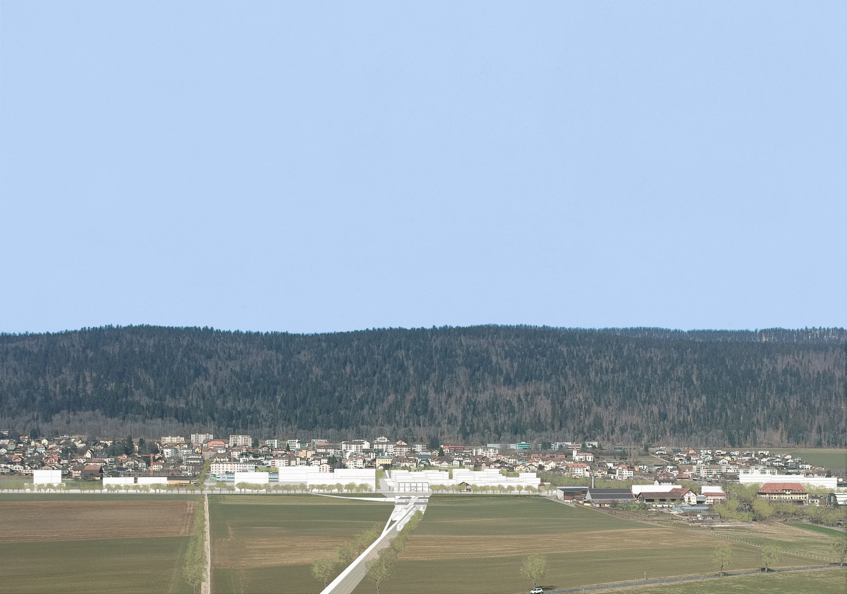
The creation of a regional train station south of the village of Cernier has generated the need to establish a village development strategy structured around three time horizons: 2030, 2040, and 2050.
The village of Cernier maintains a distinctive relationship with the broader landscape. Built on a hillside, the town enjoys spectacular views over the plain and the mountain horizons. At the same time, its street-village structure, characteristic of Jura watchmaking-era urbanization, asserts its central position, reinforcing the triple topographic, geological, and agronomic hinge linking the arid limestone slope to the fertile silty plain. Cernier is a piedmont town, built on springs, upstream of its rigorously drained agricultural basin.
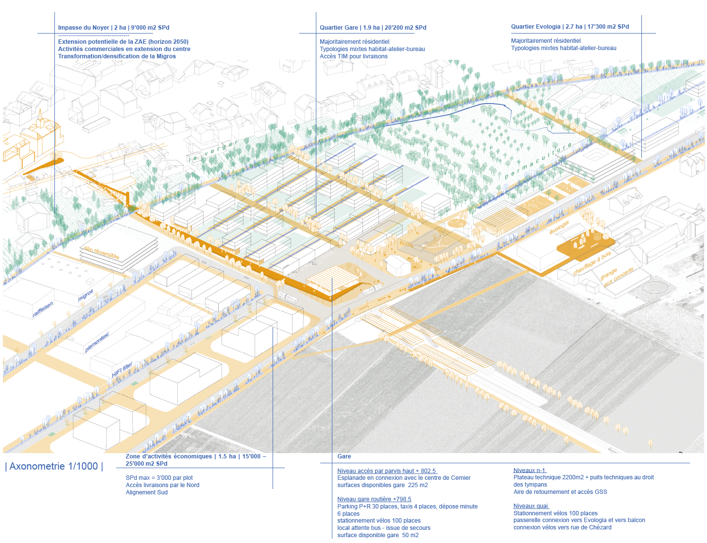
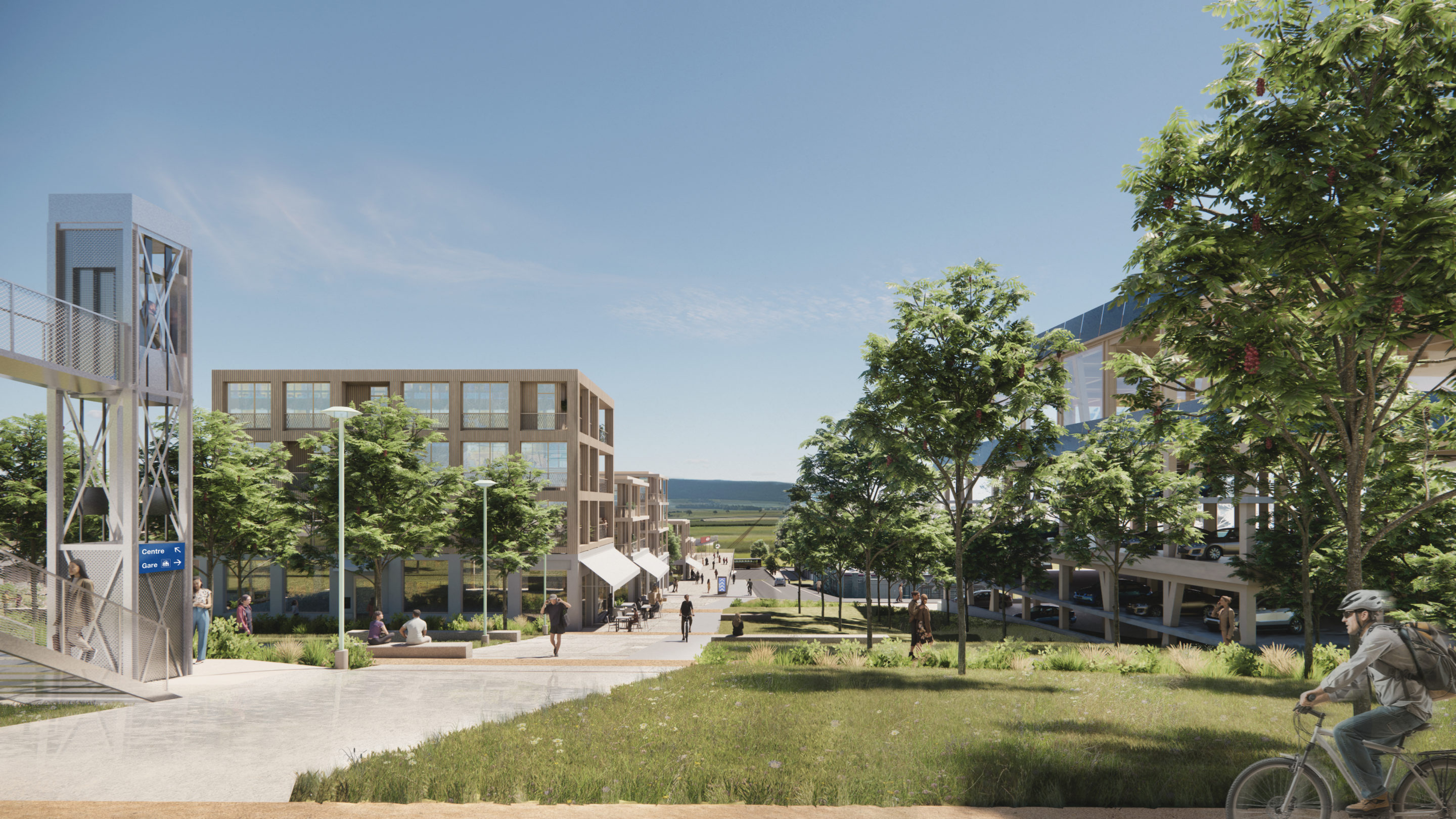
The development strategy we propose is rooted in the logic of watchmaking-era urbanism and in the existing structures, developing a new urban and ecological grid in the new district.
This grid takes up the geometric characteristics of the region, notably the Junod and Knab plans that structured the emblematic urban spaces of La Chaux-de-Fonds and Le Locle in the 19th century. The new grid adopts proportions identical to these historical examples; however, it is no longer simply a framework for roads and buildings, but a hybrid structure — for roadways as much as for the blue and green networks, for quality indoor and outdoor spaces alike, for the differentiations and distinctions needed to foster biodiversity, for water management, and for a balance between nature and development.
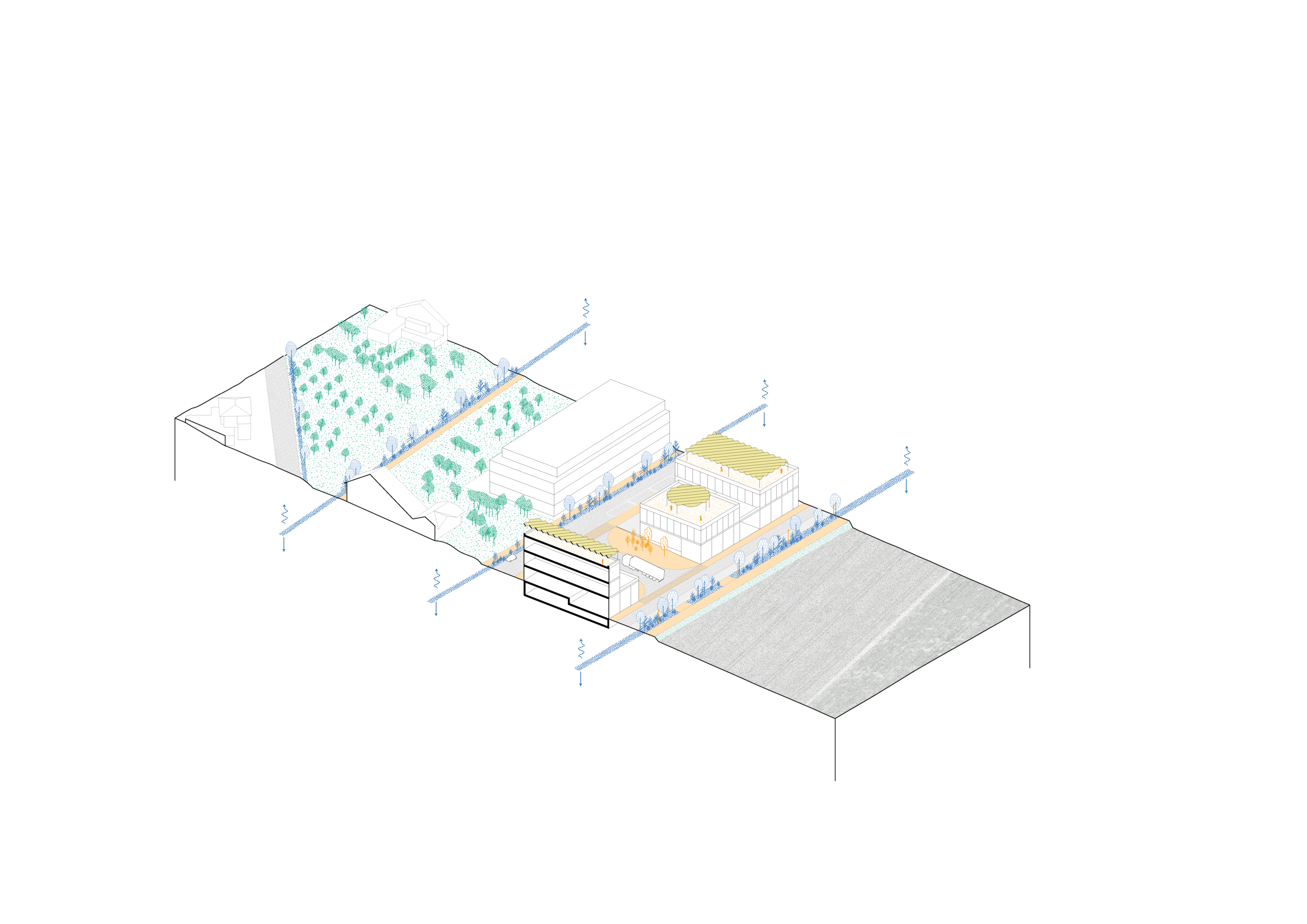
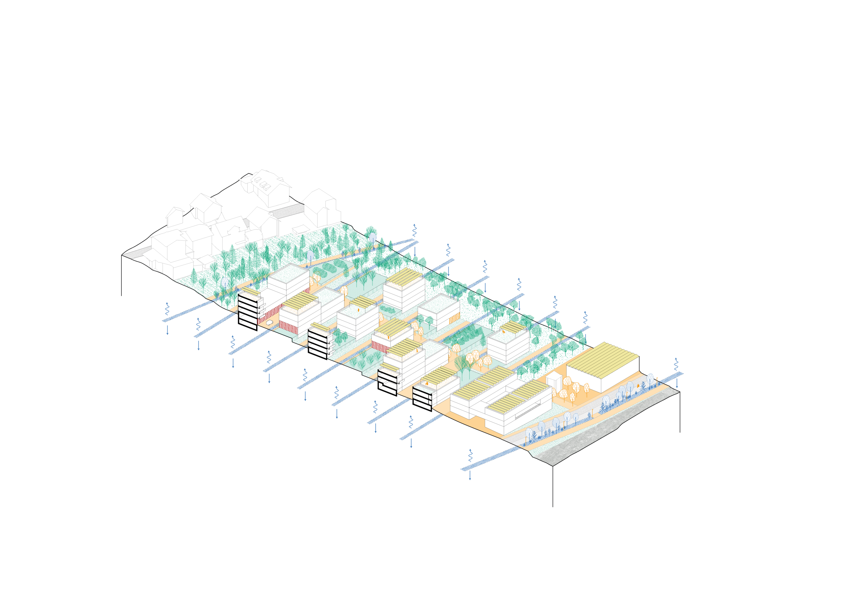
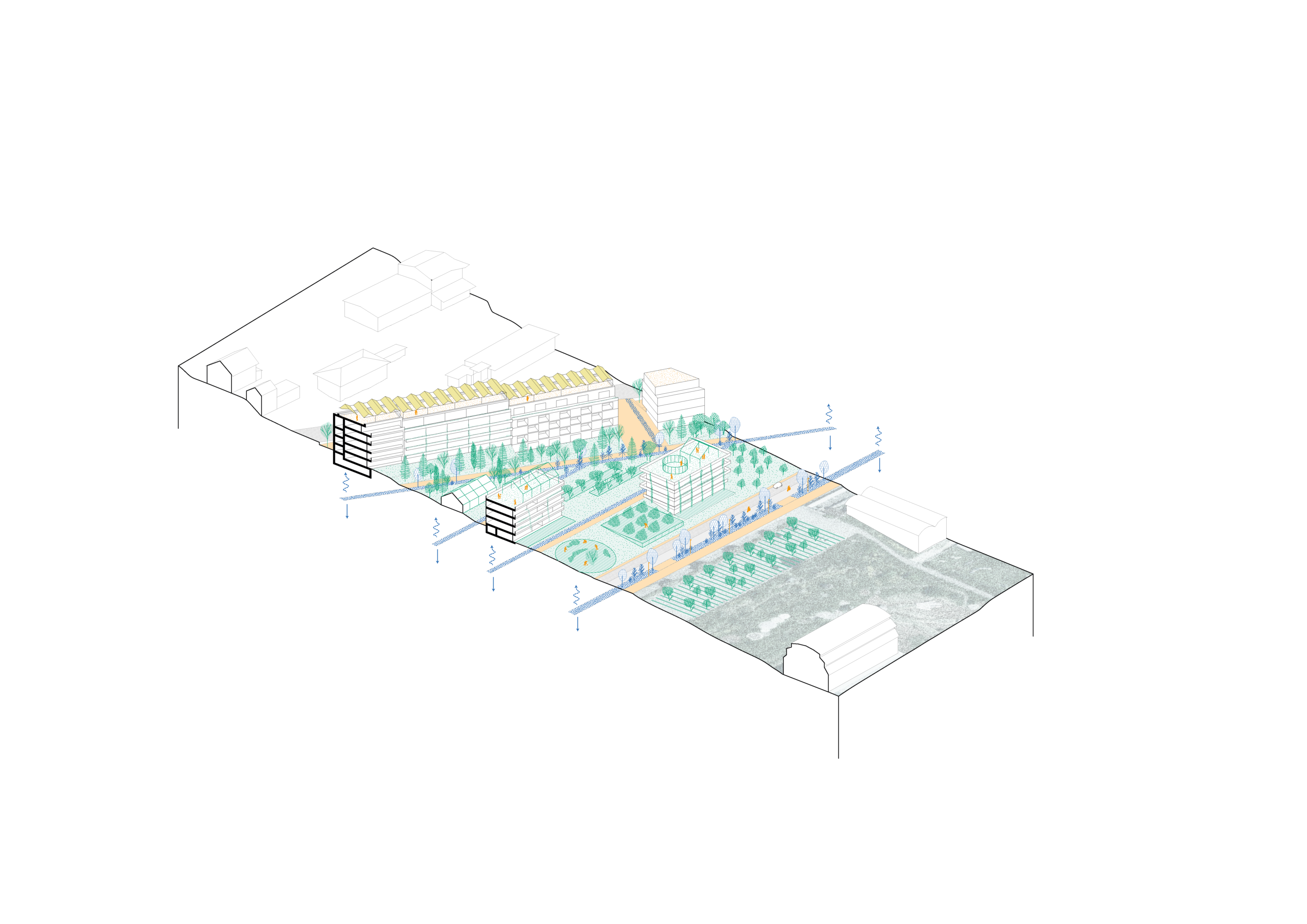
It is bounded by a balcony overlooking the landscape, set against the town and supported by the topography, whose surface is designed to serve both as a soft-mobility axis and as a structuring public space, ensuring the continuity of the urban grid. As an anchor point on the landscape, this balcony allows future neighborhoods to be inscribed within a hybrid urban and ecological system.
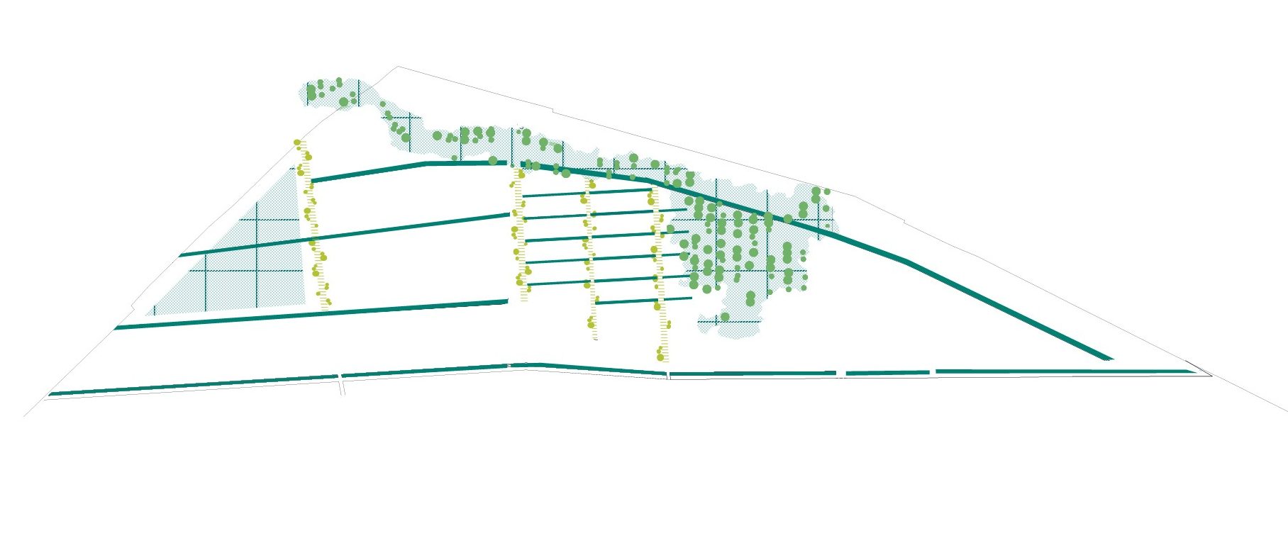
The design of this new grid determines the perimeters for building placement. It also enables the development of multiple networks, infrastructures, and ecological frameworks, drawing on strong landscape motifs, such as fruit-tree alignments and orchard-meadows.
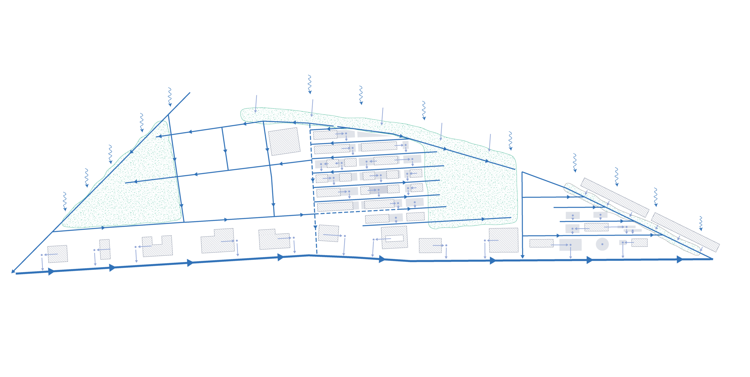
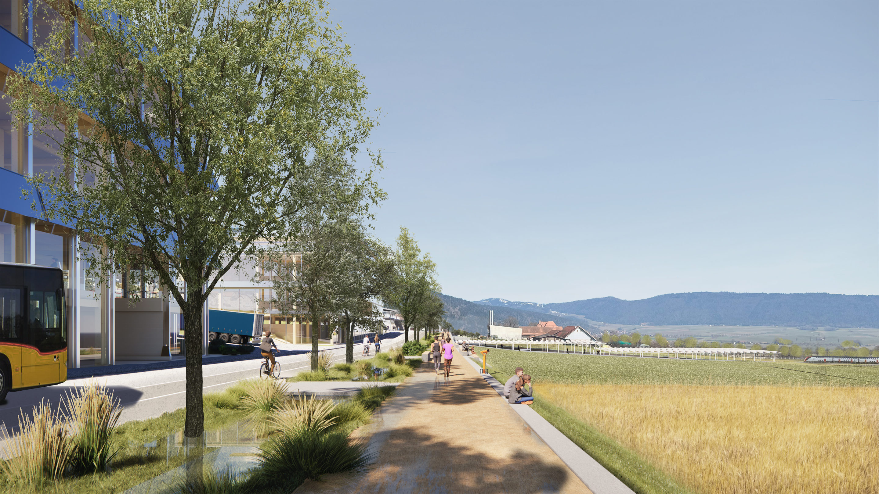
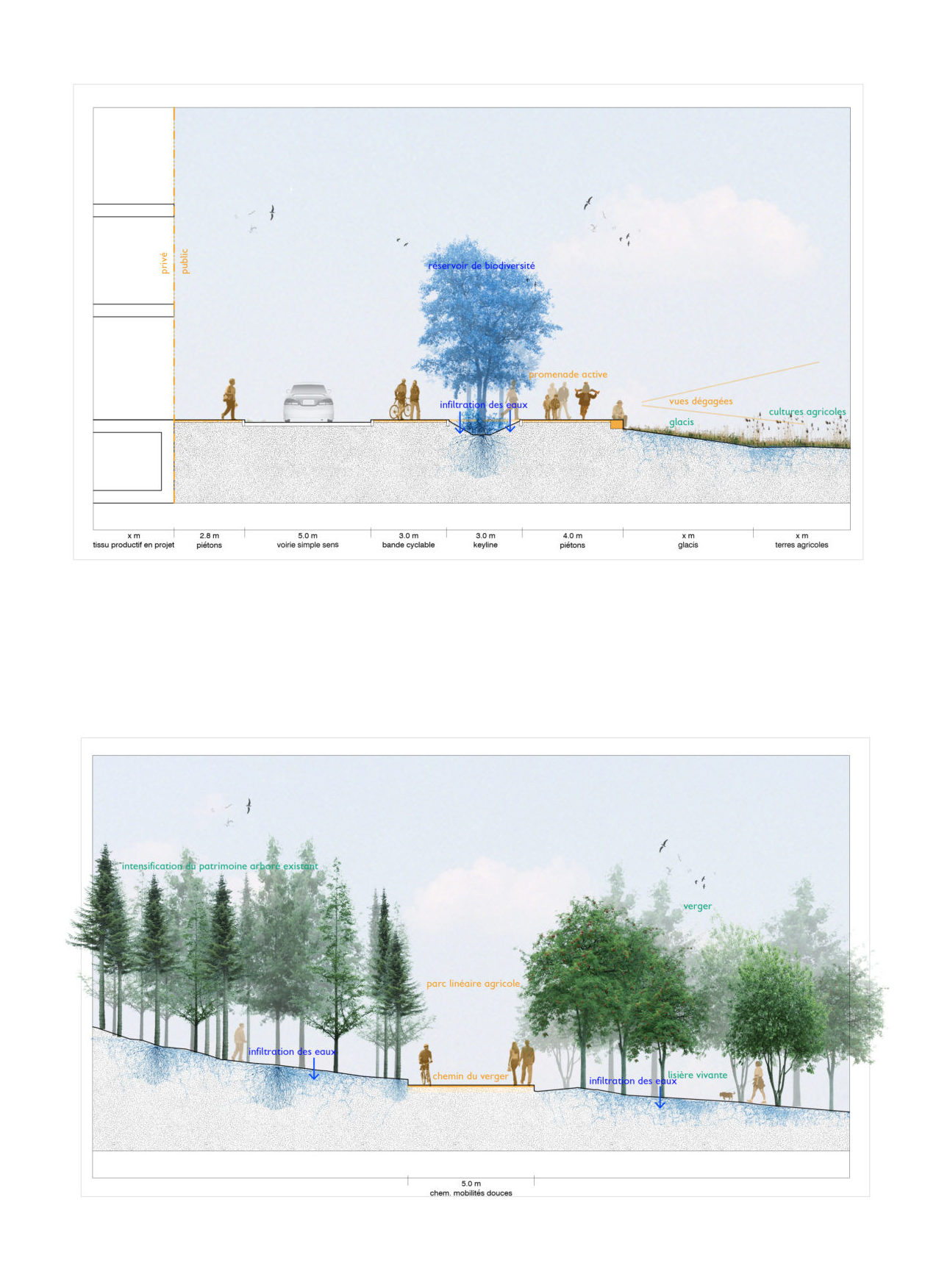
This grid enables the development of regenerative hydrological management, where the keyline network structures the pathways of water and ecological corridors, allowing for the establishment of living soils that safeguard biodiversity. The keylines — east/west planted swales — regulate and infiltrate water. True reservoirs of biodiversity, they accompany pathways and reinforce the landscape framework. These ecological and landscape continuities help maintain openings onto the valley and the broader landscape.
The project’s landscape strategy establishes a landscape grammar composed of the balcony, the keylines, the fruit-tree crossings, and the orchards.
It is anchored in the pre-existing landscape elements on the site and in the Val-de-Ruz landscape, and reinforces ecological continuities by integrating biodiversity at every scale of the project (public spaces, planted roofs, green networks).
The structuring grid incorporates these landscape elements and enables active, evolving water management across the three time horizons.